Need to speak with an Advisor?
GIS Certificate Advising
-
CEOAS majors: Schedule an appointment with your CEOAS advisor.
- Non-CEOAS majors: Students interested in learning about or declaring the certificate should schedule an appointment with Erin Heim through Beaver Hub.
- Post Bacc students ONLY pursuing GIScience Certificate at OSU: Make sure to schedule with Associate Head Advisor Erin Heim through the Advising page linked above.
- All: Time sensitive problem, need an override, or other registration issues? Email ceoas.undergrad@oregonstate.edu (Include name, ID, and what you need to discuss.)
Humans have been making maps since we learned to walk upright, from stick drawings in the Stone Age to cutting-edge satellite imagery in the Age of Artificial Intelligence. Images of landscapes and neighborhoods, continents and oceans, help us understand the world around us, and each other, in new ways. Geographic Information Science (GIScience) combines theory and principles underlying geospatial data collection and analysis with modeling, map-making and the human dimensions of such data collection.
The Oregon State Undergraduate GIS Certificate consists of 27 credit hours (please note that additional prerequisites may be required based on the student's selected courses and/or prior math coursework). The certificate can be completed either as an addition to any degree program, as a standalone certificate by students without a college degree, or as a post-baccalaureate certificate. This program empowers students to utilize geospatial data to analyze environmental and social issues.
Certificate holders will be in demand as spatial analysts in the government, environmental, health, agricultural, construction, and tech sectors, among others. Read on for information about degree requirements and curriculum.
Why GIScience at Oregon State?
- World-class faculty who have garnered national and international awards
- Online program provides an economical and flexible choice for distance education students
- Real-world experience through a 10-week internship in a GIScience field
- Oregon State’s status as an Esri Development Center which confers special status as an exemplary GIS program

Meet the faculty

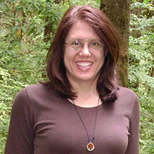
Program director, Kuuipo Ann Walsh
Employment opportunities in GISciences have grown substantially over the last 10 years. With a GIScience certificate, students will be more in-demand than ever.
Faculty
- Core Faculty (Level 1) - GIScience Coordination Committe
- Teaching Faculty (Level 2)
- Adjunct Faculty (Level 3)
Learn about careers
What Can I Do with My Certificate (PDF on Box)
Many Oregon State Geographic Information Science certificate students go on to graduate programs in geospatial science, geography, natural resources, and more, while others enter the work force right away. Recent Oregon State Geographic Information Science certificate students are now employed at:
- NV5 Geospatial Solutions
- Esri
- Oregon Department of Transportation
- Washington Department of Natural Resources
- Polk County Public Works
- Big Sur Land Trust
- Conservation Biology Institute
- GeoComm