

Geography and Geospatial Science
GIS Day November 16-19, 2026
Wilkinson, Burt, Peavy and Strand
The Geography and Geospatial Science program at OSU is excited to invite you to Geography Awareness Week and GIS Day 2026! We welcome all students, faculty, and interested persons to participate - see the offered events below.
| DAY & TIME | EVENT | PLACE | DESCRIPTION |
|---|---|---|---|
| Mon. Nov. 16 9 am – 3 pm | Ground observations and GLOBE Observer activities Host: Peder Nelson | Peavy Field | Come learn about how drone imagery bridges the gap between field observations and satellites. Visitors can stand on the ground, collect measurements, then immediately see those same locations from a drone perspective before connecting them to Landsat, Sentinel-2, and other Earth-observing systems. Then become a part of NASA’s citizen science efforts to learn more about environmental change through remote sensing. |
| Mon. Nov. 16 6 – 8:30 pm | YouthMappers Mapathon contest Host: Margot Pullen | Strand Hall 363 | Curious about mapping and its impact on our world? Join our mapathon contest to start mapping! Our project focuses on disaster relief and hazard mitigation by mapping buildings and infrastructure in remote areas. Food will be provided, come hang out and map with us using Open Street Map! Image

|
| Tue. Nov. 17 11– 11:50 am | Map Gallery Presentations Matthew Goslin & Jim Thatcher | Burt 193 and virtual | Join your Geospatial buddies and showoff your maps! Each person will be allowed five minutes to share the juiciest bits of a StoryMap or Geovisualization effort you’ve been involved with, followed by time for mingling. Email Matthew Goslin to learn more, and sign up on the 2026 GIS DAY Map Gallery Sign-up sheet. Zoom link for this map-sharing event |
| Tue. Nov. 17 1 – 1:50 pm | GitHub & Professional Portfolios Workshop Host: Alec Ramirez | Burt 193 and virtual | Information session on selecting a platform for your GIS portfolio with examples of each. Alec Ramirez will provide a demonstration of his GitHub site and provide advice on how you can develop one of your own. |
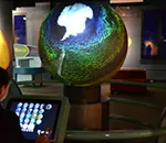
| Tue. Nov. 17 2 – 2:50 pm | OmniGlobe demo Host: Alec Ramirez | Wilkinson 204 Collaborative Learning Space (CLS) | Explore animations of numerous natural global systems and events, such as the ENSO and tsunamis; as well as human influences on our global systems through the mesmerizing OmniGlobe - a 32” spherical projection system. Two students will demonstrate how the Omniglobe simulates Earth geological, atmospheric, and other Earth (and non-Earth) processes Image
|
| Tue. Nov. 17 3:30 – 5 pm | GIS-STEP Panel Hosts: Kuuipo Walsh & Fred Polinder | Burt 193 and virtual | Formal presentations where undergraduate interns showcase their 10-week summer projects |
| Wed. Nov. 18 10 – 10:50 am | AI and the Future of GIS Presenter: Esri Education Team | Burt 193 and virtual | The Role of AI and the GIS Professional |
| Wed. Nov. 18 11 – 11:50 am | GIS Careers in the Age of AI Host: Fred Polinder | Burt 193 and virtual | Employer and alumni panel discussing:
Panelists:
|
| Wed. Nov. 18 1 – 1:50 pm | Atlases as Transdisciplinary Tools Host: Jim Thatcher | Burt 193 and virtual | Explore how atlases integrate science, policy, culture, and community knowledge. Demo and Panel discussion?
|
| Wed. Nov. 18 2 – 2:50 pm | Mapping for Decisions Workshop (bring your own computer to this session) Host: | Burt 193 and virtual | Hands-on activities using (Living Atlas and Oregon Explorer) to explore:
|
| Wed. Nov. 18 4 – 5:00 pm | Marston Lecture | OSU Memorial Union Ballroom and Zoom | Title: Beyond Yellowstone: Working Lands, Wildlife, and Conservation Speaker: Drew Bennett, Ph.D. '15, MacMillan Professor of Practice, University of Wyoming |
| Wed. Nov. 18 5 pm | Marston Lecture Reception & GIS Day Celebration | OSU Memorial Union Ballroom | Social and GIS Day Cake. See you there! |
| Thur. Nov. 19 10 – 11:50 am | Geospatial Faculty Meeting | Wilkinson 203 | Meeting with Esri |
Last updated 11/6/2026