Posted April 19, 2018
Despite the closeness to our shores, there is still quite a bit we don’t know about the coastal ocean. Oceanographers have spent decades increasing their global reach: they have multiple satellites circling our world's oceans measuring surface temperature and ocean color. They have submersibles mapping underwater mountains. There are even thousands of free-drifting sensors roaming the ocean gyres. Given their worldwide reach, you’d think scientists would have uncovered the mysteries of the coastal ocean long ago.
But in reality, scientists are still trying to understand what makes the coastal ocean tick, from the flow of its waters on- and off-shore to its intricate layering of temperature and salinity. In some cases, scientists know more about far-flung regions of the ocean, such as the equatorial Pacific, than areas in our backyard.
One of those areas is the inner continental shelf. Ranging from 15 to 150 feet deep, the inner shelf is the area just beyond where waves break. It often stretches far from shore (three miles here in Oregon) and forms part of the mighty continental shelf – a skirt of seabed that extends beyond the land’s end before plunging down into the deep.
The inner shelf is an area of profound beauty, teeming with life and supporting critical fisheries and other commerce. This sliver of coast is also distinct from the rest of the shelf. Shallow waters that crash onto the beach are driven by pounding waves, and deeper waters beyond the inner shelf are moved by winds that create currents. Yet the inner shelf is its own kind of Wild West, where the force that rules the region – waves, wind or tides – is open for debate.
Dozens of scientists – including those from the College of Earth, Ocean, and Atmospheric Sciences – have recently joined forces in a state-of-the-art experiment, called the Inner Shelf Dynamics Project, aimed at studying the inner shelf. Funded by the Office of Naval Research for $11 million, the project is the culmination of years of planning, collaboration, and determination. It builds on findings of a previous continental shelf project, connecting scientists and engineers past and present.
Oceanographers expressed considerable interest in the inner shelf in the 1990s, when a scientist at Woods Hole Oceanographic Institution, Steve Lentz, wrote papers about its importance in the coastal ocean. There was concern that lack of knowledge about the inner shelf would jeopardize the rest of coastal science. The inner shelf is an intermediary between the shoreline and the deeper waters, a region where water flows back and forth driven by strong currents and is a key part of coastal circulation as a whole.
The increasing popularity of computational models in the late 1990s created a new impetus to study the inner shelf. Scientists were developing high-resolution coastal models to predict currents and temperature, invariably making assumptions about the workings of this dynamic region. But it was incredibly difficult to test the models without real-life data. To do that, scientists would need to face notoriously inhospitable conditions.
Most oceanographers steered clear of doing experiments on the inner shelf, and for good reason. Even the deeper reaches of the inner shelf, at 150 feet, are on the edge of manageable for mid-sized research vessels. Smaller boats can safely operate in the middle depths, but they historically lacked the instrumentation needed for open-ocean research.
These problems plagued coastal oceanography for the past several decades, when studies abounded just offshore of the inner shelf, and in shallower water using tripods and piers, but not in the awkward middle. Despite Lentz’s call for action, the inner shelf remained a mystery.
Professor Jack Barth has been an oceanographer at Oregon State University for 30 years. The Inner Shelf Dynamics Project is his second foray into studying the complexities of the inner shelf.
His first experiment was almost 20 years ago. He moored a line of instruments to the ocean floor off the coast of Oregon as part of the Partnership for Interdisciplinary Studies of Coastal Oceans (PISCO) program. He and his collaborators managed to put in moorings as shallow as 25-feet deep using small boats. The data looked promising, but Barth wasn’t satisfied.
“We would get a glimpse, like okay, this looks like an interesting spot. But we had no idea what the real three-dimensional picture looked like,” Barth says. “It was frustrating.”
But in the following decades, technologies started to improve. Scientific instruments began to allow researchers to measure ocean currents using a single, shoe-box sized device moored to the ocean floor or bolted to the bottom of a boat. The acoustic Doppler current profilers, referred to as ADCPs, send out a pulse of sound and measured the backscatter, using the differences in frequency to calculate the speed of the water.
This improvement led to a swath of new possibilities. Suddenly, smaller boats could mount backscattering current profilers to their tiny frames and traverse the inner shelf, taking data. The mass-production of cheap temperature sensors helped too, making it affordable to string together instruments and moor them to the ocean floor for months at a time. The technological improvements were making the inner shelf more and more reachable.
And yet, in planning future inner shelf projects, Barth knew it couldn’t be that easy. The complexity of the region would demand a heightened level of scrutiny. Improving the existing coastal models, for example, would take extensive data, ideally from measurements made at many places at once over time. Furthermore, Barth saw novel ways of studying the coast emerging in the field, such as remote sensing technologies, but he lacked the expertise to use them.
“I realized that one lab could not do it,” Barth says. “It would take the entire community.” And to do that, Barth would need to draw upon the lessons of an earlier project in oceanography, one that he participated in as a graduate student, for answers.
In the last days of summer in 1982, Barth prepared to leave for his first trip out to sea. He was 21 years old, fresh out of his bachelor’s degree program and about to start his graduate studies in physical oceanography at the Woods Hole Oceanographic Institution. He had traveled from Colorado to the waters of San Francisco Bay to help his soon-to-be graduate advisor collect instruments from a nearby ocean field site.
Barth’s first graduate advisor, Bob Beardsley, had recruited the young student to help with the finishing touches of his ambitious project, the Coastal Ocean Dynamics Experiment, or CODE. CODE was an all-out campaign to study the mid-shelf, the region just beyond the inner shelf, ranging from 150 feet to 1,000 feet deep.
A typical experiment aspired to put, at most, two or three moorings in the water, but Beardsley's project put in six times that. He brought dozens of scientists onto the project from an array of research institutions. The project garnered more than $2 million dollars of funding from the National Science Foundation, a significant investment in coastal science.

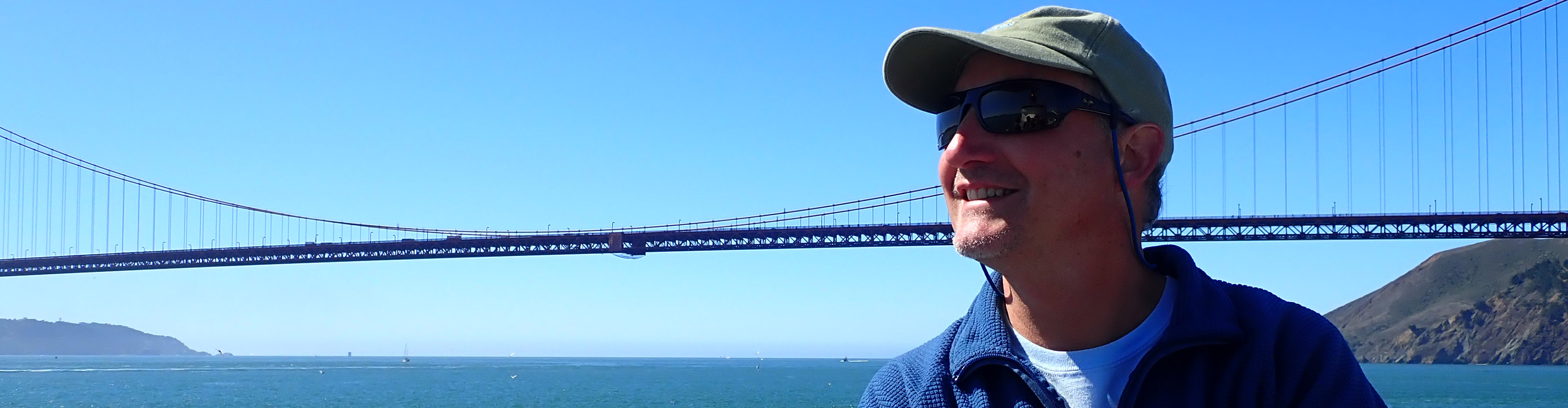
Barth was aware of the importance of the project, but for the most part, he was concerned with adjusting to sea life. The voyage was his first trip out to sea. He watched enthralled as the research boat, R/V Wecoma, sailed underneath the Golden Gate Bridge, the massive red beams stretching above, dwarfing him and the vessel alike. A photo from those days shows Barth on the Wecoma as it sailed back to port under the Bay Bridge. He points out his full head of blonde hair: "I keep telling my son that that was true."
Barth didn’t end up analyzing any of the CODE data during his graduate degree, focusing instead on other work. Still, it was impossible to miss the surge of scientific findings that amassed in the following decades.
“It was a huge success,” he says. “It produced a big jump in the field.”
Indeed it did. There is even a three-inch “CODE volume,” that holds hundreds of pages worth of scientific findings from the project. And that’s just the first five years of research, says Barth. After that, he says, “it keeps going and going.”
Barth got the idea that the inner shelf project could mimic CODE’s gigantic scale. He teamed up with two Scripps scientists, Bob Guza and Falk Feddersen, to write a white paper for the Office of Naval Research. Their thinking was this: if the Navy funded the project under their special large projects grant, called Departmental Research Initiatives, then it would be possible to pool the resources of dozens of scientists into one experiment.
The resulting whitepaper submitted to the Navy has echoes of the CODE legacy: the paper proposes a project to collect a “milestone” dataset and stresses that “the time is ripe” for staging an all-out campaign on the region. It also emphasizes the elusive nature of the inner shelf, calling it a “black box” and a “complicated and poorly known gateway region.”
The proposal struck a chord with the Navy, and the call went out to scientists from all institutions to join the project.
The response was remarkable: more than 40 scientists signed on from 12 research institutions, specializing in fields ranging from coastal modeling to ocean acoustics to high-frequency radar. The science party would install more than 160 ocean moorings in a 30-mile stretch of central California coastline. Simultaneously, six boats – three research vessels and three smaller craft – would take consecutive samples for weeks at a time, towing ocean instruments through the water. At certain times, the six boats would line up and drive parallel to each other along the coast while taking data, a bobbing armada dotting the California shoreline.
But the scientists didn’t stop there. They constructed five radar towers on the beaches overlooking the field site. The radar towers, along with two drones and one small aircraft, gave the research team an unprecedented look into the ocean’s processes without stepping a foot in the water. The scientists celebrated the fact that, at the end of data collection, they would have a concurrent dataset from both the air and the sea, a far cry from Barth’s first moorings some 20 years before.
McSweeney speaks with the conviction of a scientist on a mission. For her, the importance of the project is twofold. First, she says this experiment could not come at a more critical time, both for the planet and for the field of coastal oceanography.

Climate change is altering Earth’s oceans, says McSweeney, from varying sea levels to the temperature of its waters. While there are many theories about how the ocean will change, and preliminary evidence too, there are still many lingering questions about the details of that change.
The inner shelf region will feel the effects of climate change through changing winds and waves. On the Oregon coast, for example, climate change is predicted to alter the strong coastal winds, modifying their pattern so that they blow more consistently in the same direction. This difference could impact fishing by affecting the rich, wind-driven coastal upwelling pattern. With Oregon fisheries supplying the equivalent of about 10,000 jobs to the statewide economy in 2016, and a harvest value of more than $144 million, future deviations may be felt close to home.
“We’re in this crucial time to make observations,” McSweeney says, before the region begins to change due to climate change. This is the time to pick apart the forces – the waves, winds and tides – and pinpoint their exact role.
McSweeney loves this challenge. “My scientific interests lie in understanding mechanisms,” she says. “This project hits the nail on the head for me.” McSweeney’s first use of the data will be to track large underwater waves caused by tides that affect the location of nutrient hotspots on the continental shelf.
Beyond collecting data, McSweeney says that the project has reverberated throughout the coastal science community, forming a new paradigm for tackling tough problems together.
“As a scientific community, oceanographers have identified themselves by the region they study,” she says. For example, one researcher may study the dynamic waters of an estuary, while another analyzes crashing waves on a beach, while a third looks at the 1,000-foot precipice at the continental shelf break. While each goes about their research independently, they have few opportunities to confer with researchers outside their specialty, as conferences are often organized around their region of study. Although interdisciplinary collaboration is becoming more common, the historical precedent of separation left the scientific community fragmented.
But the inner shelf project is changing that, says McSweeney.
“Where this project really shines is that it is attempting to bridge the gaps in these communities,” she says.
Her comments fit with a frequent refrain from scientists on the project’s research cruises; many said the experiment was either the shallowest water or deepest water that they had ever worked in. Those same scientists talked excitedly with one another, asking about their research in another subfield. Through coming together to explore an underexplored region, scientists were mending the separations within their professional world.
McSweeney believes this is a step forward for science, but also trains researchers to be better communicators in general. “It is an extremely important time for our scientific community to start talking more with each other,” she says. Practicing a more open dialogue among oceanographers, “will play an important role in our ability to start improving our communication skills with the general public.”
It will take some time before Barth and others see an “Inner Shelf Volume” of their own. Data collection wrapped up in the fall of 2017, and researchers met at the Ocean Sciences Meeting in February 2018 to discuss preliminary findings and future analyses. There will be plenty of sorting and sifting through data in the years ahead.
Looking back, Barth is thankful for the inspiration from his past mentors. He admires the ambitious scale of CODE and how long-lived the data were. Despite the fact that the data were collected more than 30 years ago, on cassette tapes sealed inside old-fashioned instruments, the dataset endured. For decades, he says, “it is something you could check against.”
When it comes to the inner shelf project, Barth says he wishes for the same. “We’re hoping that this is true for our dataset. That it will live on.”
See more feature stories